The Tersus Luka is a powerhouse of precision packed into a compact, fully rugged GNSS receiver. Engineered for the professional who demands both portability and flexibility. From land surveyors and GIS experts to utilities personnel and drone mapping specialists, the Luka is built to thrive in any environment.
This lightweight marvel provides continuous, all-day operation and incredible versatility. Deploy it as a high-accuracy rover, or use it as a portable RTK base station broadcasting corrections via NTRIP using its internal modem, or its integrated radio.
It’s the ultimate tool for capturing razor-sharp Ground Control Points (GCPs) or logging base data (Rinex) for PPK workflows to elevate the accuracy of your drone surveys and aerial mapping projects.
One Lightweight GNSS. Endless Survey-Grade Possibilities.
The Luka isn’t just a GNSS receiver, it’s a compact powerhouse for survey and mapping professionals.
Ultra-lightweight, portable, and easy to deploy
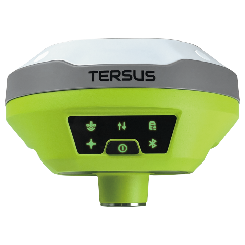
Full-featured RTK GNSS with tilt-capable IMU sensor fusion
Built-in 1-Watt UHF, 4G modem, Wi-Fi, and NFC connectivity
8 GB of onboard memory for storing Rinex files
Rugged IP67-rated housing for harsh field conditions
All-day battery for uninterrupted field productivity
Flexible solution for GCP collection, RTK base stations, and versatile mapping workflows
Configure through a web-ui on any kind of device through WIFI.
Free use of the Tersus Caster Service, a cloud service to transmit and receive corrections over cellular connections, for Oscar bases and rovers. You can support multiple brands of rovers from a single base.
The Luka is a compact, lightweight, fully rugged GNSS multitool that is always ready for the job at hand. Despite its small size, it delivers full RTK functionality, internal radio, and a SIM-enabled modem, making it versatile for any field workflow. Lightweight enough for easy deployment, it lets surveyors, GIS teams, and Drone professionals work longer and smarter, and without fatigue.
Office Value
Simple one-button ease of use, eliminates complications in the field for office managers.
Back in the office, Luka’s precise survey data integrates seamlessly into mapping and GIS workflows. Accurate RTK corrections, ground control point data, and NTRIP-based measurements ensure that teams can confidently analyze, validate, and process field data without delays or uncertainty.
Seamless Esri Integration
Integrates directly with ArcGIS Field Maps, Survey123, and other Esri field apps, bringing high-accuracy positioning into your GIS environment.
Drone Base Station Ready
Serve as a dependable base for drone missions, supporting both real-time RTK and post-processed (PPK) workflows.
TAP Real-Time Corrections
Access Tersus TAP global correction service for real-time accuracy, anywhere, anytime, without the need for a local base or radio link.
Built In-House by Tersus.
Built to Perform for You.
At Tersus, building “just another RTK system” is never the goal. Tersus designs and develops its own GNSS boards and core RTK technologies, building solutions from the ground up rather than relying on generic, off-the-shelf components. It’s a simple belief that guides every receiver we’ve built: build better, or don’t build at all. Every receiver delivers high-performance, centimeter-level RTK accuracy without unnecessary cost, providing reliability and precision in even the toughest environments.