Precision GNSS & LiDAR Solutions for
Smarter Field Data Management
Desert Creative Group (DCG) Geospatial provides cost-effective GNSS, LiDAR and 3D scanning solutions that support accurate field measurement and location intelligence.
We help organizations adopt reliable equipment and workflows that fit real project needs and existing data environments. DCG Geospatial is the geospatial technology division of Desert Creative Group, focused on GNSS, LiDAR, data collection, and 3D scanning solutions across the United States and Canada.
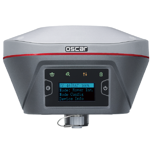
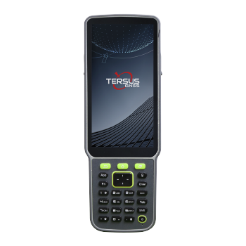
As the master distributor for Tersus GNSS in the United States and Canada, we offer hardware and systems that deliver dependable centimeter-level results at a practical cost.
Our team supports surveying, construction, land development, utilities and GIS operations that need consistent accuracy, efficient field work and stronger data management practices.
Many organizations need accurate data but face high equipment costs. We offer GNSS, LiDAR and 3D scanning solutions that balance affordability and performance. Teams get reliable results. Managers reduce equipment spending without sacrificing accuracy.
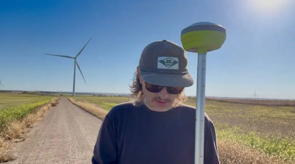
Centimeter Accurate GNSS Solutions
Tersus GNSS systems deliver consistent accuracy in a wide range of conditions. Field crews rely on predictable performance. We support base and rover workflows, RTK network access and field software integrations that help teams work efficiently with fewer errors.
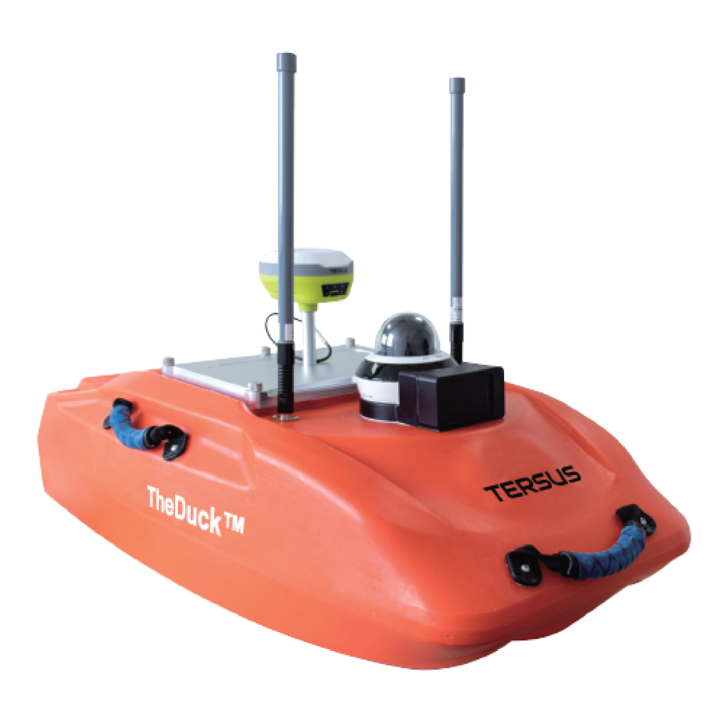
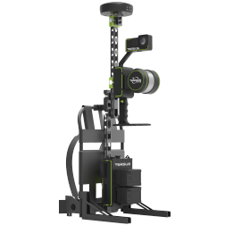
LiDAR and 3D Scanning Workflows
Modern projects rely on detailed surfaces, structures and terrain. We help organizations integrate LiDAR
and 3D scanning systems into CAD, GIS and BIM environments. Teams collect more usable data in less time and keep projects on schedule.
Our Approach
Support Every Step of the Way
We focus on solutions that support real work in the field and office. Our guidance helps teams work efficiently, avoid delays, and improve the value of every dataset collected. This approach ensures that every system fits your project requirements, software environment and long-term goals.
Product Selection & Workflow Expertise
We help organizations choose the right GNSS, LiDAR and 3D scanning systems for their work. Our recommendations are based on project needs, accuracy requirements, and the data management workflows your teams rely on. We make sure each system fits your environment and supports long-term operational growth.
Technical Support
We provide ongoing support for hardware, firmware, and workflow questions. Our goal is to help field and office teams stay productive, maintain
accuracy, and reduce downtime.
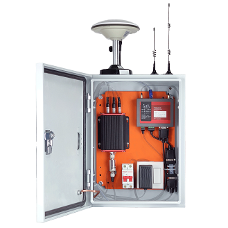
DCG Geospatial distributes and supports the full Tersus GNSS ecosystem across the United States and Canada, offering reliable, high-accuracy positioning solutions designed for surveying, mapping, and construction professionals.
Complete Base & Rover Kits
Flexible configurations for field-ready deployments
RTK & Network-Connected Workflows
Support for local base stations and network corrections
Survey, Mapping & Construction Applications
Built to perform across diverse job sites
Field Software Integrations
Compatible with common survey and GIS platforms.
Cost-Effective GNSS Solutions
Lower total cost compared to traditional GNSS systems.
Multi-constellation GNSS Support
Consistent performance with dependable accuracy.
Centimeter Level Accuracy
Precision you can rely on for critical measurements.
How Tersus GNSS Compares
Tersus GNSS stands apart through in-house technology development and field-proven performance, delivering advanced positioning solutions without unnecessary complexity or cost.
In-House GNSS Technology Proprietary chipsets and the Extreme-RTK Engine developed by Tersus
Fast Setup & Easy Adoption Streamlined workflows reduce training and onboarding time
Reliable in Real-World Conditions Consistent performance across varied environments
North America Support Coverage Fully supported throughout the U.S. and Canada
Strong Software Integration Works seamlessly with widely used survey and GIS software
DCG Geospatial delivers more than equipment. We help teams implement, optimize, and scale their GNSS workflows with hands-on expertise and long-term support.
Growth & Business Development
Strategic support to help geospatial teams expand their capabilities and reach.
Expert Technical Support
Fast, practical troubleshooting backed by real-world geospatial experience.
Team Training & Enablement
Hands-on training for both field crews and office professionals.
Data & Workflow Expertise
Streamlined data and production workflows built for real projects.
Our Brands
Tersus GNSS
Hardware designed for practical, dependable and accurate field performance. DCG is the master distributor for the United States and Canada.
Esri
GIS technology used for spatial analysis, mapping and location intelligence workflows across organizations of all sizes. Desert
Creative Group is a Bronze-level Esri Partner.