Skip to content
Image of the Desert Creative Group Logo
  • +1 (208) 423-7422
Contact Us
  • Home
  • Products
    • Receivers
    • Controllers
    • Bathymetric
    • LiDAR
    • Real-Time Corrections
    • Software
  • GIS
  • Become a Partner
  • Resources
  • About DCG
  • Corporate Website
  • Home
  • Products
    • Receivers
    • Controllers
    • Bathymetric
    • LiDAR
    • Real-Time Corrections
    • Software
  • GIS
  • Become a Partner
  • Resources
  • About DCG
  • Corporate Website
  • Shop Products

    The Tersus GNSS Luka

    Ultra-Compact

    LUKA is a palm-sized, full-featured IMU-GNSS receiver and meets the demand of centimeter precision positioning in challenging environments.

    From land surveyors and GIS experts to utilities personnel and drone mapping specialists, the Luka is built to thrive in any environment. This lightweight marvel provides continuous, all-day operation and incredible versatility.

    Tersus GNSS Oscar Trek

    For Visual Surveying

    The Tersus premier RTK smart GNSS receiver combines a high-definition camera, IMU tilt compensation, and GNSS for seamless, non-contact measurements.

    It processes images in real-time to instantly provide precise coordinates, streamlining project completion. It is compatible with leading 3D modeling software and utilizes raw data for accurate, flexible post-processing in creating detailed 3D models.

    The Tersus GNSS Oscar Ultimate

    Without Integrated Camera

    Equipped with an advanced multi-constellation and multi-frequency GNSS board, the Oscar Ultimate GNSS receiver ensures exceptional accuracy and consistent signal detection.

    Note that it lacks the integrated high-definition camera for visual surveying that’s included in Oscar Trek.

    The Tersus GNSS David30 Receiver

    Affordable, Professional GNSS

    The David30 receiver sensor offers exceptional versatility, making it a perfect GNSS solution for numerous specialized applications. It seamlessly integrates with Tersus GeoCaster for NTRIP corrections and serves as a dedicated base station.

    Additionally, it excels as a GNSS sensor for mobile mapping, machine control, precision agriculture, and UAV systems applications needing real-time corrections.

    Tersus GNSS TC80 Android Controller

    Powerful platform for data collection

    The TC80 is an ultra-lightweight handheld for surveying and mapping applications, weighing only 320 g and measuring just 1.96 cm thick. This controller is designed ergonomically, considering its optimized usage in the field. Its grip is designed to be held with one hand, making it easy to operate.

    The Tersus GNSS TC40 Android Tablet Controller

    The Tersus TC40 Controller is a rugged, easy-to-use field device built for demanding survey work. Its 8-inch touchscreen delivers clear visibility outdoors, while a powerful octa-core processor and Android operating system ensure smooth performance with Tersus Survey software.

    A removable high-capacity battery provides up to 10 hours of continuous use, keeping crews productive all day. Designed with durability in mind, the TC40 features a protective housing and IP67 rating, making it reliable in harsh field conditions.

    Tersus GNSS TheDUCK UAV

    Bathymetric Surveying

    TheDuck™ is an autonomous surface vessel designed for bathymetric surveys of aquatic environments like rivers, lakes, reservoirs, and coastal areas. It features an optional single-beam echo sounder and offers remote-controlled real-time display capabilities, allowing for control from over a mile away.

    Tersus GNSS MVP 100 Mobile Mapping System

    Fly Light. Map Right. Aerial or Mobile Applications

    The MVP 100 delivers survey-grade results with typical point cloud accuracy of 3–5 cm using PPK, supported by high-precision LiDAR measurements. Its triple-return capability and long detection range enable reliable ground extraction even in dense vegetation and complex terrain. 

    Tersus GNSS MVP S1 SLAM Scanner

    Handheld SLAM Scanner

    An AI-driven RTK-SLAM engine combines LiDAR, vision, and GNSS data to deliver accurate, reliable positioning even in complex environments.

    Tersus GNSS MVP S2 SLAM Scanner

    Handheld or Backpack SLAM Scanning

    TheTersus MVP S2 is a professional-grade mobile 3D SLAM scanner that delivers sub-3 cm absolute accuracy using advanced RTK-SLAM technology.

    The system includes a high-precision LiDAR, panoramic camera with a 1-inch Sony sensor and Leica lens, dual hot-swappable batteries (up to 3 hours of uninterrupted data collection per set), and full processing software.

    TersusPNW

    CORS Network Software for Reliable, Scalable RTK Services

    Tersus Precision NetWork (PNW) RTK System Management and Positioning Services Software powers everything from a handful of reference stations to full regional CORS networks, delivering fast, reliable, centimeter-level positioning to thousands of users at once.

    Tersus GNSS TAP Real-Time Satellite Correction Service

    Tersus Advanced Position (TAP)

    TAP delivers global Precise Point Positioning (PPP) with accuracy of 1.5 cm horizontally and 3 cm vertically. Works seamlessly with Tersus smart GNSS receivers.

    Available in one, two, and three-year subscription plans.

    The Tersus GNSS Geobee

    RTK Permanent Mounted Base Station Kit

    The Tersus GeoBee is an affordable permanent reference station, for transmitting or receiving NTRIP corrections.

    When combined with Tersus NTRIP Caster Service, NTRIP Modem, and David30 GNSS Receiver, the GeoBee enables users to easily send Real Time Kinematic (RTK) corrections via Ethernet, 2G/3G/4G connections using just a SIM card, or Ethernet cable, without requiring a static IP.

    The NTRIP caster service supports multiple bases simultaneously.

    Tersus GNSS NUWA Field Software

    Your All-In-One Solution

    Nuwa is a field survey app designed for Tersus controllers or other Android devices that works seamlessly with Tersus Smart GNSS receivers.

    It features a graphical interface with a background map for CAD stakeout, road stakeout, Earthwork, tilt survey, and COGO tools for area perimeter, azimuth distance, and grid to ground calculations.

    Esri GIS Field Apps

    Powered by Esri

    Connect people, locations, and data using interactive maps. Work with smart, data-driven styles and intuitive analysis tools. Share your insights with the world or specific groups.

    TersusPNW

    CORS Network Software for Reliable, Scalable RTK Services

    Tersus Precision NetWork (PNW) RTK System Management and Positioning Services Software powers everything from a handful of reference stations to full regional CORS networks, delivering fast, reliable, centimeter-level positioning to thousands of users at once.

  • Brands
  • GIS
  • Become a Partner
  • Resources
  • About DCG
  • Corporate Website

Desert Creative Group Signs Distributor Agreement with Laser Technology, Inc.

Laser Technology Rangefinders

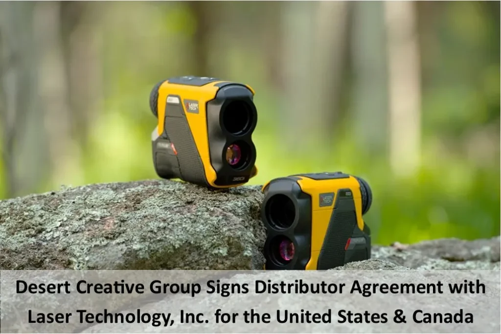
Laser Technology, Inc. (LTI), headquartered in Centennial, Colorado, to supply LTI’s professional measurement laser rangefinders throughout the United States and Canada.

Plumb Positioning Equipment Named Tersus GNSS Authorized Reseller

Blog post image showcasing the Plumb Positioning Equipment logo and the Tersus GNSS Authorized Reseller logo side-by-side. You can read "Desert Creative Group Welcomes Plumb Positioning Equipment as New Tersus GNSS Authorized Reseller in NC, SC, Parts of GA & TN" below the logos.

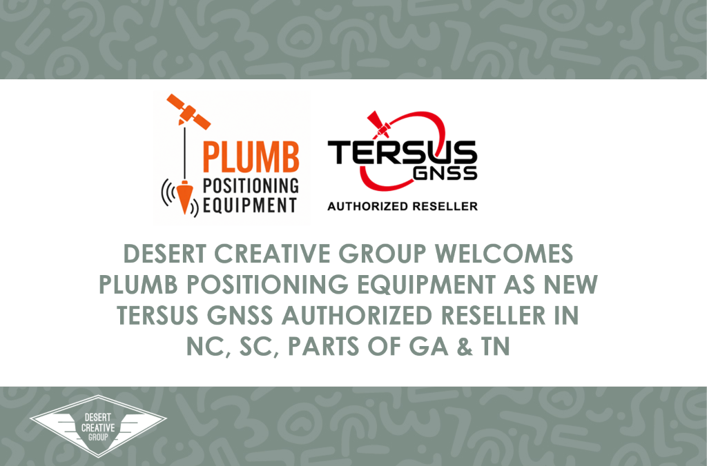
We are pleased to announce Plumb Positioning Equipment, LLC, as the newest authorized reseller of Tersus GNSS solutions.

United Surveying Supplies Named Tersus GNSS Authorized Reseller

Blog post image showcasing the United Survey Supply logo and the Tersus GNSS Authorized Reseller logo side-by-side. You can read "Desert Creative Group welcomes United Surveying Supplies as a Tersus GNSS Authorized Reseller in Austin, Texas" below the logos.

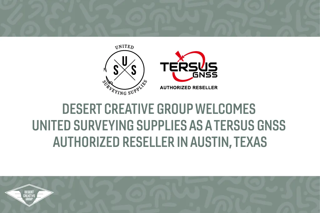
We are proudly announcing United Surveying Supplies (USS), headquartered in Round Rock, Texas, as a new authorized Tersus GNSS reseller.

Tersus GNSS Now Compatible with Esri ArcGIS Field Maps and Survey Apps

Image of a man standing in a road using the Tersus LUKA. There is a picture of a TC80 on the side showing the software being used.

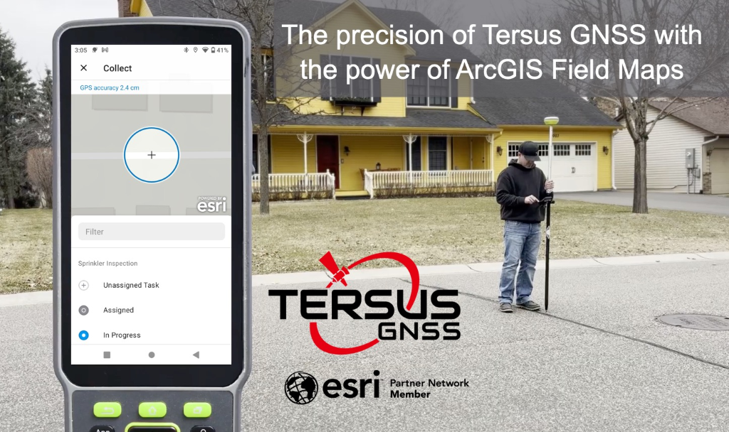
We are excited to announce official support for Tersus GNSS receivers with ArcGIS Field Maps, Survey123, and QuickCapture on Android.

Vertex Unmanned Solutions Named Tersus GNSS Authorized Reseller

Blog post image showcasing the Vertex Unmanned Solutions logo and the Tersus GNSS Authorized Reseller logo side-by-side. You can read "Desert Creative Group Welcomes Vertex Unmanned Solutions as new Tersus GNSS Authorized Reseller in Minnesota" below the logos.

DCG welcomes the addition of Vertex Unmanned Solutions as a new authorized Tersus GNSS reseller for the state of Minnesota

Valhalla Instruments Named Tersus GNSS Authorized Reseller

Blog post image showcasing the Valhalla Instruments logo and the Tersus GNSS Authorized Reseller logo side-by-side. You can read "Desert Creative Group Welcomes Valhalla Instruments Inc. as New Tersus GNSS Authorized Reseller in Colorado and Wyoming" below the logos.

We welcome the addition of Valhalla Instruments Inc. as a new authorized Tersus GNSS reseller.

Desert Creative Group Signs Master Distributor Agreement with Tersus GNSS

Image of the Desert Creative Group team holding Tersus GNSS Equipment outside of a building labeled "City of Twin Falls". The words "Desert Creative Group signs master distributor agreement with Tersus GNSS" along the bottom of the photo with the DCG Logo and Tersus GNSS Logos on either side.

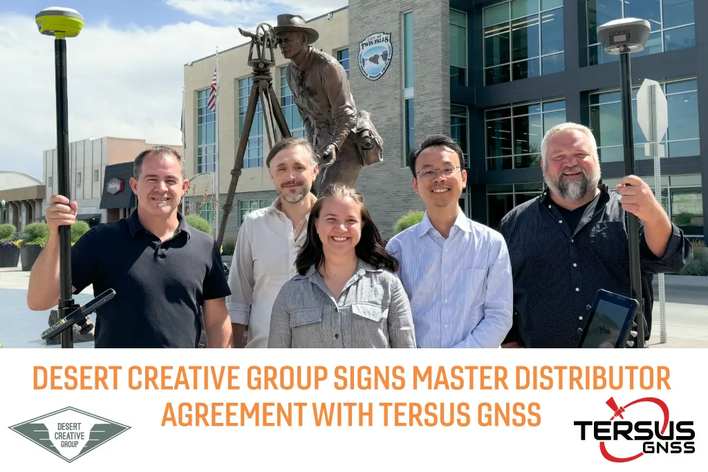
Desert Creative Group (DCG) has signed an agreement with Tersus GNSS, headquartered out of Melbourne, Australia, to supply professional positioning equipment to the United States and Canada.

White Desert Creative Group Logo

Navigation

Home
Brands
GIS
About DCG
Privacy Policy

Products

Receivers
Controllers
Bathymetric
LiDAR
Real-Time Corrections
Software

©2017- 2025 Desert Creative Group LLC. All rights reserved worldwide.
Desert Creative is a registered trademark of Desert Creative Group